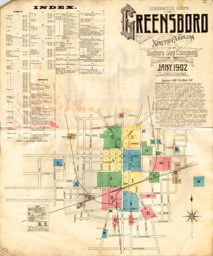
Index to the 1902 Sanborn map of Greensboro
The Archives has five original volumes of Sanborn Fire Insurance Survey Maps of Greensboro for the following years: 1902, 1907, 1913, and 1925 (one set with additions through 1933 and one updated through 1955/57).
The North Carolina Collection at UNC-Chapel Hill has digitized all of its Sanborn maps through 1922. Start by reading their introduction to Sanborn maps and their collection, or go directly to their Sanborn maps of Greensboro.
The only subsequent Sanborn map of Greensboro was originally published in 1925 and updated through the 1950s. An unaltered 1925 edition and one updated to 1950 can be accessed through NC LIVE, a collection of online databases available to North Carolina citizens through their local public libraries.
If you are a patron of the Greensboro Public Library system, go to their list of databases and then scroll down to Sanborn Maps. If you are a North Carolina resident and live outside of Greensboro, check your local public library’s website to find this resource.